View the Data: PhysCharacter_GL
There is one spreadsheet in this data set.
General Questions:
- Does elevation have anything to do with the direction of water flow?
- Which lake has the highest elevation?
- Which lake has the lowest elevation?
- Is there a relationship between retention time and volume?
- Which lake has the longest retention time? The shortest retention time?
- Which lake has the highest volume? The lowest volume?
- Which lake has the most shoreline?
- Which lake has the most water or surface area?
Note: For a question to be testable, the locality, time and variables must be specific.
This simple data set is a good starting point for exploring other more complex data sets. The data could be used in an elementary classroom for basic graphing or as a tool to engage learning. Comparisons can be made between lakes, such as comparing lake depth and elevation. Students can look for relationships using other clues within the data.
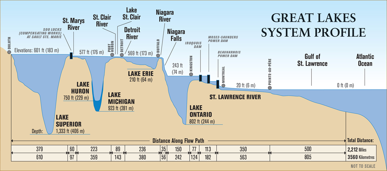
Depth profile of the Great Lakes system.
Great Lakes System Profile graphic, courtesy of Michigan Sea Grant, The Great Lakes Basin, map/poster.
Data source: NOAA-Great Lakes Environmental Research Laboratory, Coastwatch.